Science & Nature
Lake Effect Snow of More Than 6 Inches Could Make Chicago’s Morning Commute ‘Dangerous to Impossible’
Winter has arrived.
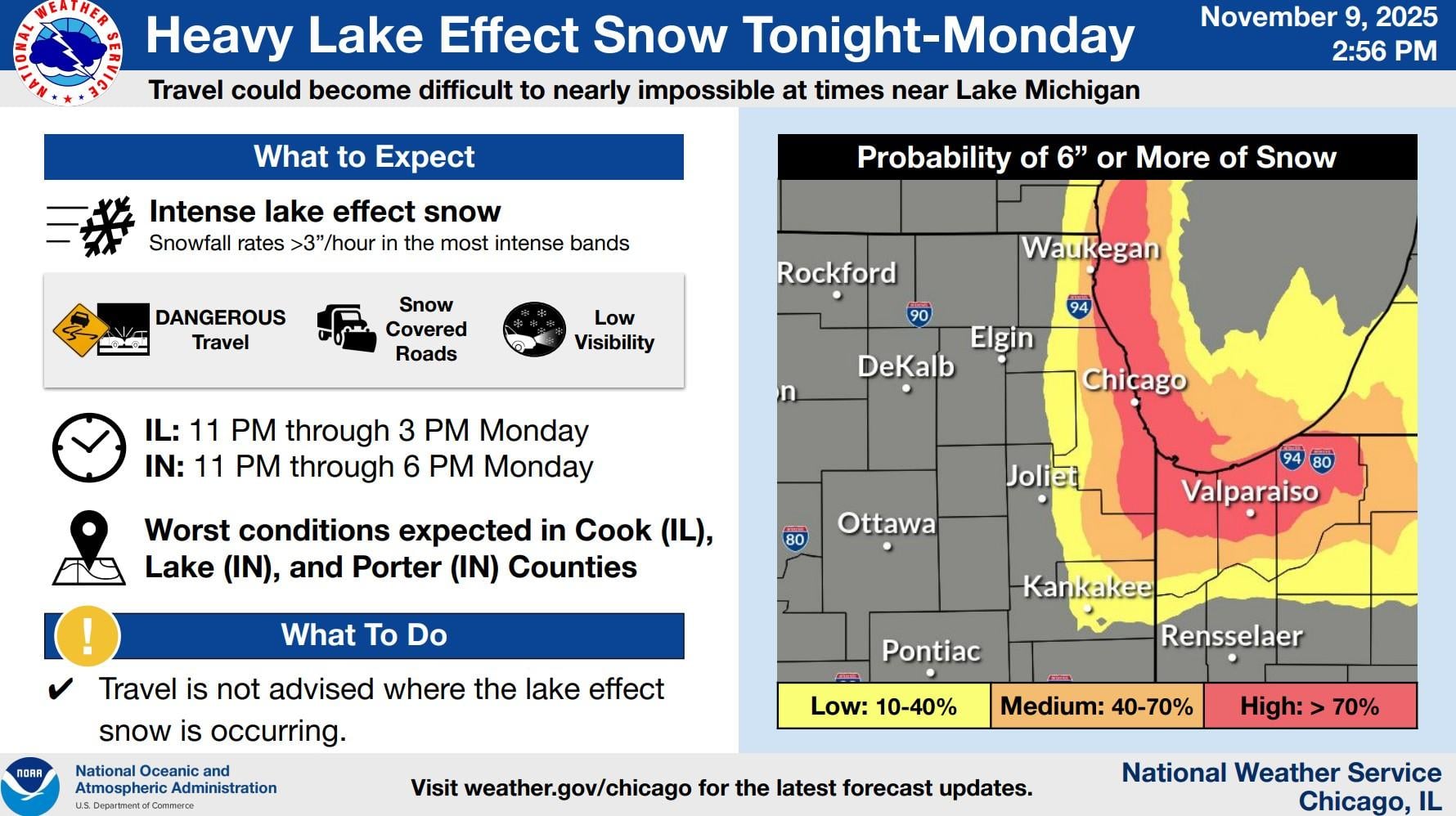
A winter storm warning is in effect with forecasters predicting intense snowfall at a potential rate of more than three inches an hour in the most intense bands, according to the National Weather Service.
The winter storm warning includes Cook, Lake eastern Will and Kankakee counties in Illinois. Northwest Indiana is also included in the warning. DuPage County is under a winter storm advisory.
The exact amount of snow could vary greatly across the region, but the latest forecasts have parts of Chicago with high probability of receiving 6 inches or more of accumulation. Areas closer to the lake will see higher totals.
Intense lake effect snow is expected Sunday night into Monday, making travel conditions in the area “dangerous to impossible,” according to the weather service. The Monday morning commute will be especially hard hit.
The most intense lake effect snow is expected to fall in Illinois between 11 p.m. Sunday through 3 p.m. Monday. In Indiana, it will last through 6 p.m. Monday.
Flurries fell Sunday morning across parts of the Chicago area, a precursor to “intense” snowfall forecast to start in the evening in communities surrounding Lake Michigan.
“This band is going to drop some very heavy snow and some hairy scenarios for the Monday morning commute,” said weather service meteorologist Kevin Doom in Romeoville, Illinois.
In Indiana, weather experts predicted up to 11 inches of snow and “slippery surfaces” for road travel. Up to 6 inches of snow were predicted in parts of Wisconsin.
Weather experts also issued special guidance for gardeners, saying the freeze warning means the growing season has ended.
“Take steps now to protect tender plants from the cold,” warned meteorologists in Arkansas.
The Associated Press contributed. This is a developing story.
")
")
")
")
")
")
