 (Michael Izquierdo / WTTW News)
Strap yourselves in, Chicagoans. It's going to be a roller coaster weather ride this week.
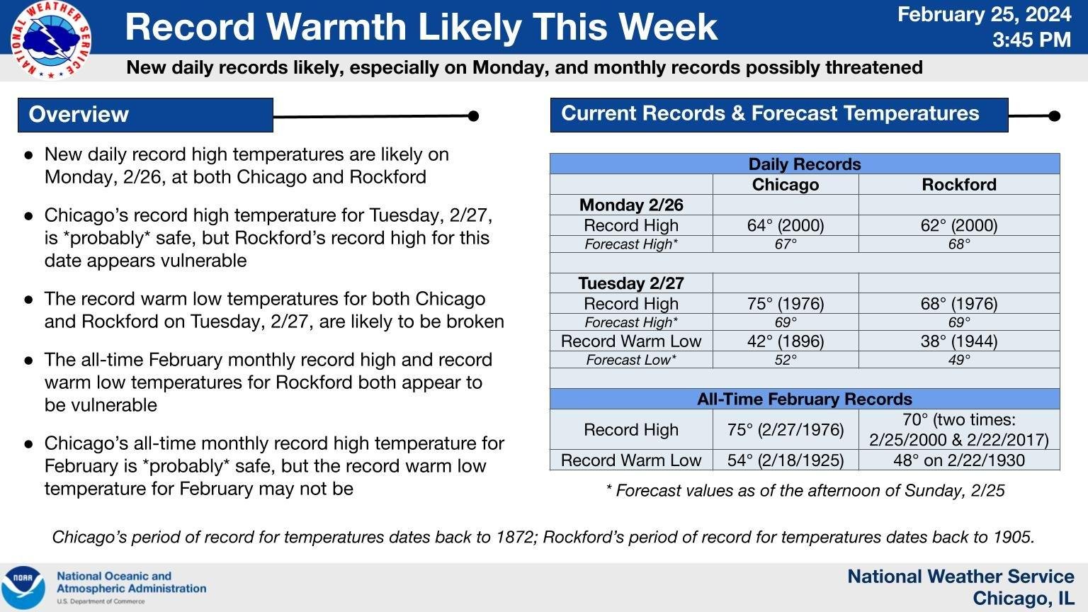
The National Weather Service is eyeballing record daily high temperatures for Monday and Tuesday, and possibly an all-time high for the month if the mercury tops 75 degrees Tuesday, as forecast. That would break a record set back in 1976. (You know the drill, Chicago: It's likely to be cooler by the lake.)
 (National Weather Service Chicago)
The down side to the warm, dry conditions and gusty southerly winds is an elevated risk of fire. According to the weather service, any grass or brush fires that ignite could spread out of control.
And that just takes us to mid-Tuesday.
On Tuesday night, what the weather service is calling "a power-house cold front" is expected to swoop in from the north, causing temperatures to plummet and bringing with it a chance for thunderstorms, hail and possibly even tornadoes.
The timing, severity and track of Tuesday's storms is still uncertain, but the weather service is currently predicting a late evening arrival, primarily south of I-80 and near or east of I-55.
Wednesday's temperatures will be in the more seasonally appropriate 20- to 30-degree range, with overnight wind chills in the teens or even single digits. Some folks could wake up to snow on Thursday morning — a wild 48-hour turn of events.
The 10-day forecast calls for temperatures to rebound back into the 60s for the upcoming weekend.
Contact Patty Wetli: @pattywetli | (773) 509-5623 | [email protected]


