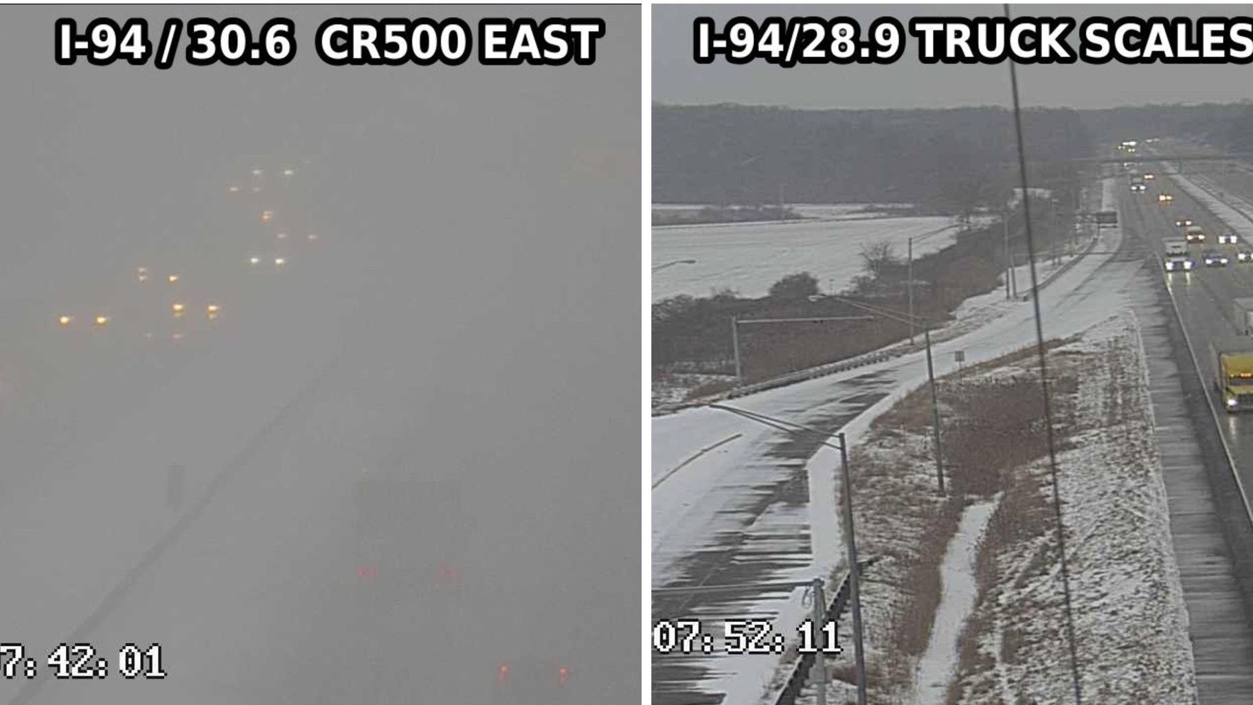
 Photos taken on Interstate-94 near Porter County, Indiana, show weather conditions scarcely two miles apart. (Indiana Department of Transportation)
A couple of highway cameras caught lake effect snow in action Thursday morning, offering a picture-perfect snapshot of one of the region’s quirkier weather phenomena.
The photos, captured on Interstate-94 by the Indiana Department of Transportation, were taken scarcely 2 miles apart. One shows near whiteout conditions, headlights barely visible. In the other: Storm? What storm?
“Conditions can vary significantly over short distances,” the National Weather Service warned.
That’s a calling card of lake effect snow, which is greatly affected by wind direction and can shift quickly, according to the weather service. Unlike large storm systems, lake effect events tend to be highly localized along a narrow band.
“Heavy snow may be falling in one location, while the sun may be shining just a mile or two away in either direction,” the weather service said.
Which isn’t to say lake effect events don’t pack a punch. Ask Buffalo.
With its location on the west side of Lake Michigan, Chicago isn’t hit by lake effect snow as frequently as the opposite shore in Indiana and Michigan, given the general flow of air. But when winds blow in from the northeast and pick up moisture from the lake, the city gets socked. 2 to 3 inches of snow can fall per hour.
Heavy lake effect snow continues to affect portions of northeast Porter Co. Check out the diff between these 2 INDOT cameras just a couple miles apart. Conditions can vary SIGNIFICANTLY over short distances, use caution if traveling & be prepared for sudden changes in conditions! pic.twitter.com/8j4OIIq27F
— NWS Chicago (@NWSChicago) January 20, 2022
Contact Patty Wetli: @pattywetli | (773) 509-5623 | [email protected]

